For many mortgage borrowers in 2025, affording the purchase of a home seems like an insurmountable task given stark affordability barriers like high home prices and mortgage rates double pandemic-era lows.
Increasingly, however, the cost of continued homeownership reflected in growing insurance burdens for homeowners and prospective buyers around the U.S. has upped the ante for those climbing (or attempting to climb) the property ladder.
A newly released Realtor.com Housing and Climate Risk Report reveals that 26.1% of U.S. homes — representing $12.7 trillion in value — are currently exposed to at least one severe or extreme climate risk, such as flooding, hurricanes or wildfires. Using data provided by Insurify, a digital insurance marketplace, Realtor.com identified markets with the highest total value of homes at risk and the largest share of home value at risk from flooding, wind and wildfire, thereby ranking U.S. metros with the highest insurance burden.
To protect against growing climate change-related risks, insurers have raised premiums or reduced coverage, with notable insurer withdrawals in Florida and California in recent years. Testifying before the Senate Banking Committee last February, Federal Reserve Chairman Jerome Powell warned lawmakers that some regions of the U.S. risk becoming entirely uninsurable within the next decade.
“If you fast forward 10 or 15 years, there are going to be regions of the country where you can’t get a mortgage,” he claimed, adding that banks will not “keep making loans in the face of evidence of disaster.”
Risk exposure gaps
Under an HO-3 plan, the most common type of single-family homeowners insurance policy in the U.S., homeowners in Miami faced the highest insurance burden among the top 100 metros analyzed by Realtor.com in its 2025 report, with a premium-to-market value ratio of 3.7%. It was followed by New Orleans at 3.6% and Cape Coral, Fla., at 2.2%. A premium-to-value ratio of 2% is commonly used by the insurance industry to define insurance affordability.
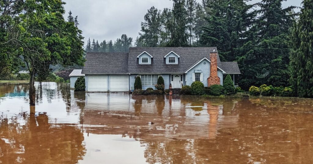
While 6.1% of U.S. homes — worth approximately $3.4 trillion — face severe or extreme flood risk, Realtor.com suggests flood risk goes largely underestimated, posing significant risks to stakeholders across the mortgage ecosystem. Flooding is the costliest peril to insure in the U.S. and the only peril that has been systematically reported.
“As flood risk modeling becomes more sophisticated, lenders must recognize that traditional maps may understate exposure crucial for accurate risk assessment,” the report’s authors write, illustrating how insurance costs can appear disproportionately high for lower-value, high-risk homes.
For example, under an HO-3 plan, a single-family homeowner in New Orleans faces premiums of about $8,328 annually — a 3.6% premium-to-market value ratio. Despite the median single-family home value in San Jose, Calif., of $1,856,000 being almost eight times higher than that of New Orleans ($231,328), the median premium paid in San Jose ($3,712) — a 0.2% premium-to-market value ratio — is less than half that paid in New Orleans.
As a component of borrowers’ monthly mortgage payments, over the past five years property insurance costs have averaged 70% growth nationally, compared to 23% in principal, 27% growth in interest and 27% growth in property taxes, according to Intercontinental Exchange Inc.’s September 2025 Mortgage Monitor Report. Insurance costs were 11.3% higher year over year in September.
Bad math
The 30-year mortgage was designed with that amortization schedule to provide a hedge against volatility and inflation but assumes environmental stability. Because borrowers are not being underwritten for long-term affordability from an insurance-expense perspective, and homes are not being properly underwritten to emerging, asset-level climate risks, ballooning escrows have begun to function like piggyback, adjustable-rate mortgages — bad math for stakeholders across the mortgage industry.
Realtor.com estimates in its report that 2 million homes representing nearly $1 trillion in value “may face significant flood risk without homeowners being aware,” stemming from outdated understandings of where flooding is most likely to occur and gaps in standard homeowners insurance policies that typically exclude flood protection. Persistent mortgage rate lock-in effects mean many borrowers are locked into whatever unpriced flood risks their homes carry today.
Despite their continued use by government housing agencies to determine which mortgage borrowers must purchase flood insurance as a condition of their home loan, outdated maps designed and deployed by the Federal Emergency Management Agency (FEMA) to identify high-risk flood zones are widely regarded as poor conveyors of property-level risk, in part due to a failure to account for heavy rainfall or incorporate modeled climate change.
As of 2025, nearly 4 million homes, valued at nearly $2.3 trillion, are located in FEMA’s Special Flood Hazard Areas, or high-risk flood zones — defined as areas with a 1% or greater chance of flooding each year. Projections by First Street Foundation, a climate risk modeling firm, suggest that an additional 2 million homes valued at $1 trillion face a commensurate degree of flood risk, but do not fall within FEMA’s high-risk zones, leading homeowners and lenders to underestimate the likelihood of flooding in those areas.
The flood insurance coverage gap this creates could spell trouble for borrowers, investors and mortgage lenders underestimating potential impacts of flooding on their homes, portfolios and borrower bases. Where significant flood exposure is comparable, Realtor.com concludes that the dollar value of real estate at risk is highest in markets with many expensive homes, while the share of home value at risk is highest in markets with lower average home values.
Escalating insurance challenges
Of the top 100 metros analyzed by Realtor.com, New York ($95 billion), Los Angeles ($65.6 billion) and San Francisco ($54.9 billion) face the largest gap in dollar terms between high flood risk as assigned by FEMA, and homes modeled as facing commensurate severe or extreme flood risk per First Street data and Realtor.com calculations. Comparing metros’ share of real estate value at risk due to flood insurance coverage gaps, New Orleans (66%), Palm Bay, Fla. (15.1%) and Chattanooga, Tenn. (11.2%) lead the list.
Low take-up rates of government-provided flood insurance through the National Flood Insurance Program (NFIP) suggest that flood risk is overlooked even in FEMA-designated high-risk zones. Realtor.com reports that less than 40% of residential properties take up NFIP policies in high-risk FEMA zones, while the average county-level take-up rate including private flood insurance options is less than 20% in high-risk FEMA zones.
The implications of escalating insurance challenges are myriad for the mortgage industry, directly impacting underwriting, property valuation and default risk, for example.
From a capital markets perspective, underestimating risk severity could lead to undetected collateral risk and increased likelihood of default, raising risk premiums for underperforming residential mortgage-backed securities over time. For loan originators, rising premiums complicate the process of qualifying borrowers by driving debt-to-income ratios higher. After disasters, borrowers facing higher out-of-pocket costs due to widening coverage gaps and higher deductibles may struggle to rebuild the homes they once owned.